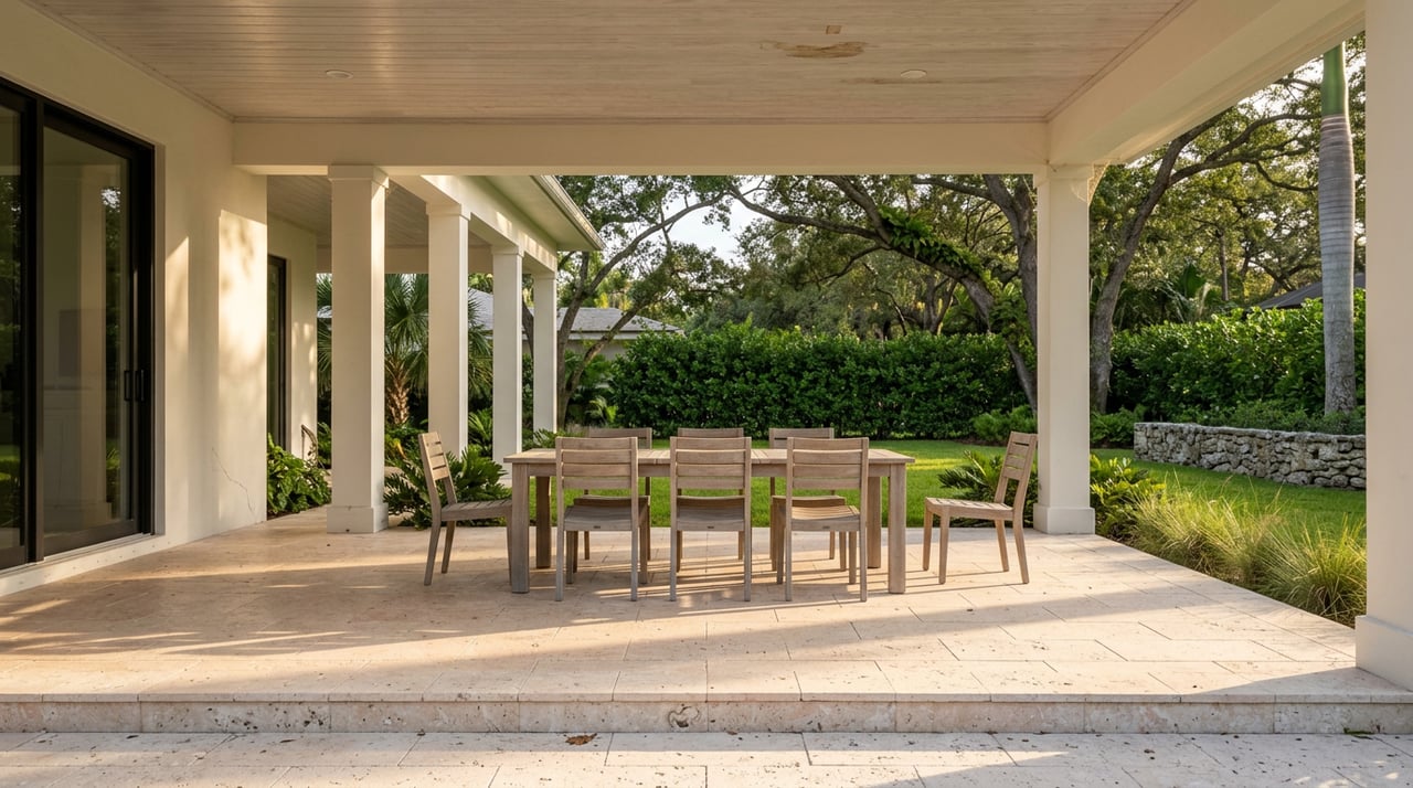
Buying in the Florida Keys should feel like a launch, not a leap. Yet the difference between a canal home and open water can decide whether your boat actually leaves the dock. You want effortless access, safe mooring, and strong long‑term value, without surprises after closing. In this guide, you’ll learn how canal, basin, and open‑water properties compare and the exact access checks to complete before you buy, including bridge, tide, depth, wave exposure, permits, and insurance. Let’s dive in.
Keys waterfront types at a glance
Canal homes
Canal properties sit on manmade or modified natural canals that connect to larger channels or bays. They usually offer private docks or finger piers and calmer water for easier docking. Depth and room to maneuver can be limited, especially near canal mouths where shoaling happens.
Typical tradeoffs include simpler, more protected dockage for small to moderate boats, along with potential draft and air‑draft limitations, slower runs to deep water, and neighbor congestion during peak times.
Basin and harbor properties
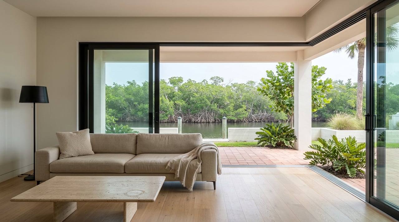
Homes on sheltered basins or coves provide more swing room and often deeper water than narrow canals. Some border community marinas or shared basins and may have rules or fees. These locations are a strong middle ground if you want protection with better maneuvering space and quicker exits to channels.
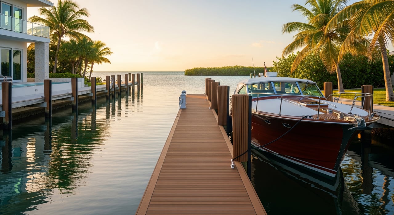
Open‑water properties
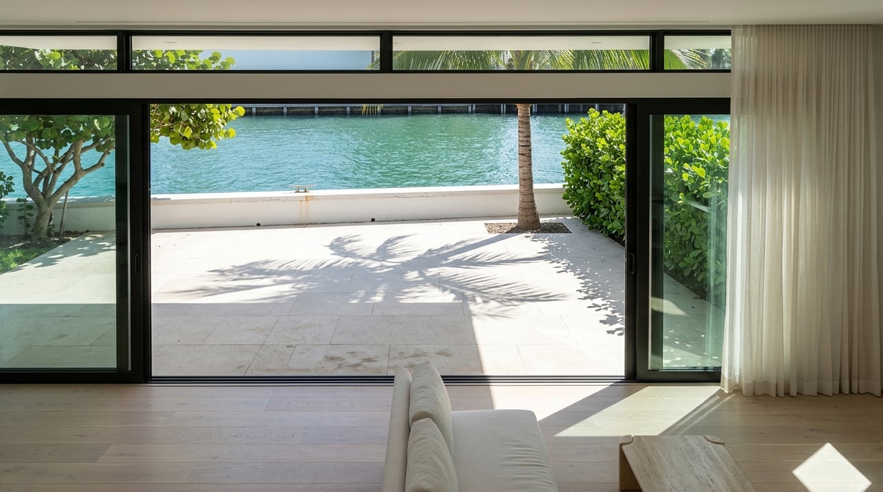
Open‑water or oceanfront parcels face the Atlantic or Florida Bay and often sit on deeper channels or passes. You get immediate access for offshore runs and bluewater cruising. Docks tend to be longer and built to sturdier standards because of wind, swell, and storm surge exposure.
The tradeoff is higher exposure and potentially higher insurance costs, along with the need for robust dockwork. This setup suits larger boats and frequent offshore use. Orientation matters throughout the Keys. Atlantic side homes feel more ocean swell and wind, while Florida Bay side homes are often calmer.
Boating access factors to check
Bridge clearances and schedules
Your boat’s air draft determines whether you can reach open water. Even if depth is fine, a low bridge can end the trip before it starts.
- Why it matters: Insufficient clearance or limited bridge openings can block access at typical tide levels.
- What to verify: Official bridge clearances, any movable bridge schedules, and the vessel’s maximum air draft including antennas and arches.
- How to validate: Use agency bridge data and chart notes, then compute available clearance at the tide you expect to transit. Call local operators or harbormasters for recent changes and consider worst‑case windows such as high tides or maintenance closures.
Tides and water levels
The Keys have a smaller tidal range than some coasts, but changes still affect both under‑keel and bridge clearance. Seasonal high water and storm surge can also impact day‑to‑day usability.
- Why it matters: Even modest swings can decide whether you clear a shallow entry or a bridge.
- What to verify: Local tide stations, the datum used for charted depths, and the tides at your likely transit times.
- How to validate: Use tidal predictions and chart datums to compute expected water depth at low and high water. Confirm any shoaling or dredging cycles at canal mouths with local records or marinas.
Depth and bottom conditions
Draft limits and bottom type shape what can live at your dock and how you anchor.
- Why it matters: Hard limits on depth restrict boat size and loading. Seagrass and soft mud affect anchoring and propeller clearance.
- What to verify: Charted depths, recent soundings, and the last dredging date. Note bottom type near the dock and along the route.
- How to validate: Review nautical charts, ask for marina or surveyor soundings, and request dredging records from the seller or association. For any anchoring or seagrass concerns, confirm local environmental mapping and rules.
Wave exposure, fetch, and shelter
Wind over distance builds waves. Orientation and local protection determine how much motion your boat sees at the dock.
- Why it matters: Exposure influences docking comfort, wear on lines and fenders, and potential damage during blows.
- What to verify: Property orientation relative to prevailing winds by season, presence of reefs, islands, mangroves, or breakwaters, and any known surge pathways.
- How to validate: Combine local marine forecasts and wind climatology with on‑site observations. Ask nearby marinas about typical conditions and historical events.
Mooring, dock, and anchoring rules
Not every property can legally maintain or modify a dock. Sanctuary and state rules can limit dredging, piling types, and anchoring.
- Why it matters: Permits and submerged land authorizations govern what you can build, replace, or maintain, and where you can anchor.
- What to verify: Existing dock permits, submerged land leases if applicable, and any sanctuary restrictions or no‑anchor zones near the property.
- How to validate: Review Monroe County, Florida DEP, and U.S. Army Corps of Engineers permit history. Ask for as‑built dock plans, piling depths, and any open violations.
Mooring depth and swing room
A wide, deep basin can be forgiving. A narrow canal with neighbor docks may not be.
- Why it matters: You need adequate water at low tide and space to turn without risking hull, props, or others’ vessels.
- What to verify: Canal width, basin geometry, tidal extremes, and obstructions like private markers.
- How to validate: Measure turning radius needs based on your boat length and handling. Confirm under‑keel clearance with a reasonable safety margin.
Hurricane and storm resilience
The Keys experience hurricane seasons that test docks, pilings, and mooring plans.
- Why it matters: Surge and wind exposure affect risk, resilience, and insurance requirements.
- What to verify: Flood zones, local surge modeling, dock construction standards, tie‑off hardware, and availability of haul‑out or storage during storms.
- How to validate: Review FEMA flood maps, local code requirements for marine structures, and nearby marina options for hurricane preparation.
Permits, environment, and insurance
Marine and shoreline permits
Waterfront work often involves multiple agencies, and each step affects cost and timeline.
- What to know: Docks, seawalls, dredging, and piling work can require approvals from Monroe County, Florida DEP, and the U.S. Army Corps of Engineers. Sanctuary regulations may also apply.
- What to request: Existing permits, as‑built plans, dredging records, and any active compliance items or violations.
Environmental protections
Seagrass, coral, reefs, and mangroves receive special protection. Rules can shape project design and ongoing use.
- What to know: Seagrass protection can restrict dredging and reduce allowed dock footprints. Elevated, pile‑supported docks may be required.
- How it affects you: Expect design constraints, specific construction methods, and potential mitigation requirements when modifying docks or seabeds.
Insurance and underwriting
Waterfront risk is not one size fits all. Orientation, exposure, and structure details drive premiums and policy conditions.
- What to know: Open‑water exposure, flood zone, dock resilience, and storm history can influence pricing. You may need wind coverage separate from standard homeowners, flood insurance, and vessel insurance.
- Practical note: Carriers may require elevated electrical systems, certified dock standards, hurricane tie‑downs, or haul‑out plans.
Zoning, HOA, and deed rules
Community and deed restrictions can limit boat types, slip usage, and modifications.
- What to know: Review HOA covenants and local code for limits on boat size, commercial use, number of slips, or transferability of dock rights.
How Miami Brokers Group validates access before you buy
Selecting a Keys waterfront property is as much a navigational decision as a real estate decision. Miami Brokers Group applies a practical, stepwise process to confirm your vessel and lifestyle fit before you commit.
- Profile your vessel and use
- We document LOA, beam, draft, maximum air draft, and how you plan to use the boat, including offshore versus bay routes and frequency.
- Verify legal dock and mooring permissions
- We collect recorded permits, submerged land authorizations, and any association rules, and identify open violations early.
- Bridge and route clearance check
- We confirm official bridge clearances and schedules, then compare to your vessel’s air draft at realistic tides. When needed, we contact local operators for updates.
- Depth confirmation
- We review charted depths and seek recent soundings near the dock and canal approach. If numbers are tight, we coordinate a marine surveyor sounding.
- Turning room and channel geometry
- We measure canal widths and basin radii relative to your turning circle. We note private markers, neighbor dock projections, and navigational aids.
- Exposure and protection assessment
- We evaluate fetch, seasonal winds, and shielding by reefs, islands, or structures. We look for signs of prior wave damage and line‑wear patterns.
- Dock and piling condition review
- For existing structures, we recommend a marine surveyor inspection of piles, decking, electrical, lift capacity, and tie points.
- Hurricane plan and storage options
- We identify local haul‑out or dry storage options and align with any insurance requirements for storm preparation.
- Environmental and permitting constraints
- We check for seagrass or sanctuary rules that would affect future dock work or dredging and outline feasible designs.
- Insurance pre‑check
- We engage insurance partners for indicative terms tied to flood zone, exposure, and dock specifications, so there are no surprises at bind.
- Decision summary
- We compile findings in plain language, highlight constraints, and coordinate specialist surveys if your use case is on the margin.
With MBG, you get integrated advisory and financing expertise under one roof, which helps you control timeline, risk, and cost from offer to close.
Which option fits common buyer goals
Immediate offshore access with a large motor yacht
Open‑water or deep basin homes usually fit best. Expect sturdier dock construction, higher exposure, and close attention to bridge routes and air draft. If a movable bridge is on your path, confirm schedules align with your typical outings.
Protected weekend runabout and low maintenance
Canal or sheltered basin properties often deliver the calm docking and easy boarding you want. Confirm depth at the dock, turning room, and any neighbor congestion at peak hours.
Sailboat with a tall mast
Air draft is often the gating factor, not depth. Verify bridge clearances at the tides when you plan to transit. If clearances are tight, consider storage or alternative routes before you commit.
Low environmental impact and legal certainty
Community basins and properties with clear, current permits are often safest for future modifications. Expect seagrass protections to shape any dredging or dock work.
Long‑term resilience and resale
Open‑water addresses can attract serious boaters but carry higher exposure. Documented permits, resilient dock design, a clear hurricane plan, and convenient haul‑out options support value at resale.
Quick buyer checklist you can use
- Measure boat LOA, beam, draft, and maximum air draft, then keep it on your phone.
- Map your route to open water, including every bridge, at the tides you will actually travel.
- Confirm charted depths and obtain recent soundings near the dock and canal mouth.
- Walk the dock and seawall with a focus on piles, cleats, power, and lift capacity.
- Stand on the dock during a typical wind for that season to feel exposure.
- Request dock permits, dredging records, as‑built plans, and any association rules.
- Verify environmental overlays, including seagrass or sanctuary rules that affect anchoring and dock work.
- Get indicative insurance terms early, including wind, flood, and vessel coverage requirements.
- Identify hurricane haul‑out or storage options in advance and note any carrier requirements.
- If any factor is borderline, schedule a marine surveyor and permit consultant before you release contingencies.
Choosing between canal, basin, and open‑water in the Keys is about matching your boat and routine to the site’s realities. With the right validation, you will enjoy smoother departures, safer dockage, and stronger long‑term value. If you want a private, finance‑savvy plan for your move to the Keys, partner with the team that treats access checks as mission critical. Reach out to Miami Brokers Group for a confidential consultation.
FAQs
What is the main difference between canal, basin, and open‑water homes in the Florida Keys?
- Canal homes are more sheltered but can have draft and maneuvering limits, basins offer more swing room with protection, and open‑water homes provide fast deep‑water access with higher exposure.
How do bridge clearances affect my boat in the Keys?
- Your boat’s maximum air draft must fit under the lowest bridge on your route at the tides you plan to travel, or you may be blocked from open water.
Do tides in the Florida Keys really impact day‑to‑day access?
- Yes. Even smaller tidal ranges change under‑keel clearance and bridge clearance, especially at canal entrances and shallow bars.
What permits should I review before buying a Keys waterfront property?
- Ask for recorded dock permits, submerged land authorizations if applicable, dredging records, as‑built dock plans, and any open violations or conditions.
Why might open‑water properties cost more to insure than canal homes?
- Open‑water exposure can increase risk from wind, swell, and surge, which can influence insurance pricing and requirements for dock construction and mitigation.
How do I know if there is enough turning room for my boat at a canal home?
- Measure canal width and obstacles, then compare to your boat’s turning circle, which is typically several boat lengths depending on hull and drive type.
What hurricane planning should I expect for a Keys waterfront home?
- You will likely need a documented storm plan that can include tie‑downs, elevated electrical systems, and a haul‑out or storage option during named storms.